phototiler logophototiler

A photorealistic map renderer and 3D map model exporter.

Dec 10, 2022 — latest release update phototiler 1.0.1

About

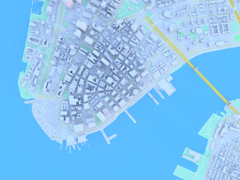
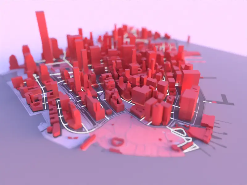
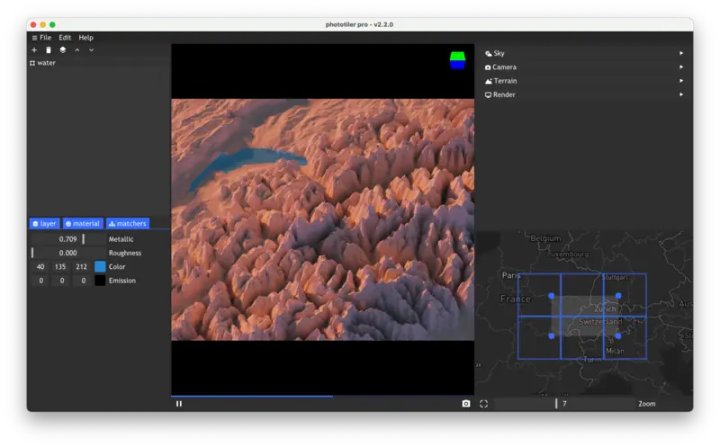
Phototiler is a lightweight photorealistic map renderer that allows quick rendering of maps for creative cartography and generate advanced 3D city models. It is a native application that works on Linux, macOS and Windows.

realistic map and 3D city rendering for cartography, architecture, urban planning and CAD software realistic map and 3D city rendering for cartography, architecture, urban planning and CAD software realistic map and 3D city rendering for cartography, architecture, urban planning and CAD software realistic map and 3D city rendering for cartography, architecture, urban planning and CAD software realistic map and 3D city rendering for cartography, architecture, urban planning and CAD software realistic map and 3D city rendering for cartography, architecture, urban planning and CAD software

Features

Phototiler provides a convenient way to create highly realistic map renderings within a minimal interface. Data can be gathered and filtered from any location in the world. Get highly accurate renders and export large city models in seconds.

Processing & Styling

Export

Rendering

Camera

phototiler interface: a realistic map and 3D city rendering for cartography, architecture, urban planning and CAD software

Your purchase supports future development of phototiler! It includes: access to Windows, macOS and Linux versions and private email support for a month.

Contact

You can subscribe to the newsletter by email and be notified about new releases and upcoming features:

Feedback is highly appreciated. If you find that some feature is really missing in phototiler, feel free to reach out to phototiler@gmail.com or go over the FAQ if you have any other questions.